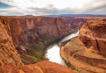
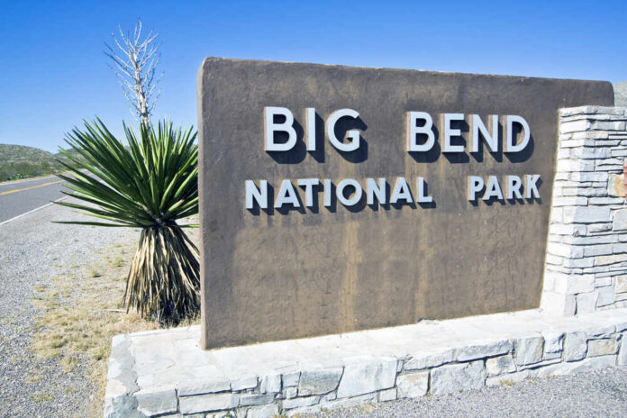
Crews moved dirt in Texas’ Big Bend, sparking a national fight over how far border security should go.
Story Snapshot
- Homeland Security waived environmental laws to speed a barrier system in Big Bend.
- Customs and Border Protection letters outlined 175 miles of wall, roads, lights, and sensors.
- Big Bend crossings fell sharply in recent years but did not drop to zero.
- Local landowners and conservation groups filed lawsuits to halt construction.
A Defined Build Plan, Not A Trial Balloon
Department of Homeland Security issued a Federal Register waiver on February 17, 2026. The move cleared dozens of environmental and cultural-resource laws that usually slow major projects. The waiver signaled a formal push to build in Big Bend’s rugged canyonlands and river corridor.
Customs and Border Protection mailed landowners detailed notices. The letters described thirty-foot steel bollard barriers, gates, patrol roads, cameras, lighting poles, power and fiber lines, and staging areas along 175 miles in Hudspeth, Jeff Davis, and Presidio counties.
Trump administration begins construction on Texas’s Big Bend border wallhttps://t.co/0dwLbjanFJ
— The Hill (@thehill) September 19, 2026
Planning records and maps outlined a layered approach. The “smart wall” concept tied steel, roads, and sensors together, with detection coverage planned along about two hundred miles.
Officials also linked the work to broader barrier funding streams. The plan emphasized cameras and lighting to extend agent reach and create response time in remote terrain. The message was clear: this package was more than fence posts in the dirt.
Why Build In A Low-Volume Sector?
Customs and Border Protection reported that Big Bend apprehensions fell to just over three thousand in fiscal year 2025. That was down seventy-four percent from fiscal year 2023.
Supporters argue that low numbers still matter because any open corridor can draw criminal traffic when other sectors harden. They also note that even a quiet sector still records crossings, which keeps agents tied up over vast distances.
Opponents counter that the sector’s share of southwest crossings remains small and that rugged cliffs and canyons already slow movement. They ask why steel should rise where the river and rock do much of the work.
Some of them claim a wall here is more symbol than solution. That argument leans on the low-volume data and the sheer size of protected lands in the corridor.
Property, Parks, And Pushback
Ranchers, outfitters, and conservation groups organized fast. Lawsuits landed in federal court to block takings and ground disturbance tied to the project.
Plaintiffs argue the wall, access roads, and constant lighting would scar public lands, cut off river access, and undercut a tourism economy built on wild scenery and dark skies. They also say cultural sites and burials could be harmed beyond repair if heavy equipment rolls in unchecked.
Advocacy coalitions urged Congress to freeze funding, citing risks to wildlife corridors and heritage sites. Their filings and public comments paint a picture of a permanent industrial footprint along the Rio Grande.
They press for cameras, remote sensing, and targeted patrols instead of steel. That technology-first view resonates with local officials who say the terrain, not a wall, is the best barrier in Big Bend.
Sorting Signal From Noise
Two facts sit side by side. The federal government documented a specific build: thirty-foot bollards, new roads, fiber, power, and lights across named counties. It used a lawful waiver to move fast.
At the same time, public maps shifted over time between longer runs of steel and larger zones of technology, which fueled doubts about the final scope. That back-and-forth created mistrust that critics have used to rally opposition.
A layered system can make sense where agents need time and eyes. But terrain and traffic should decide the mix, mile by mile. A cost-benefit test that compares steel, sensors, and patrols would strengthen the case in court and in public. If the numbers show steel adds little in this sector, technology should take the lead. If not, build where it does the most good first.
What To Watch Next
Courts will test the waiver and land access. Contracts and change orders will show whether steel miles shrink while sensor miles grow. Sector data will tell whether crossings shift or stall as pieces go in.
Congress will decide whether to fund next phases or demand a tighter plan that proves gains in this rugged stretch. Accountability here looks simple: show the miles, show the metrics, and match the tool to the terrain.
Sources:
doggett.house.gov, marfapublicradio.org, yahoo.com, nobigbendwall.org, ourpubliclandsandwaters.substack.com, ca.news.yahoo.com, earthjustice.org, latimes.com